
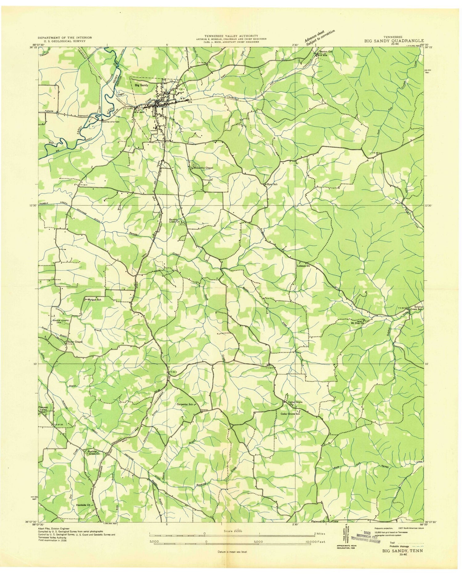
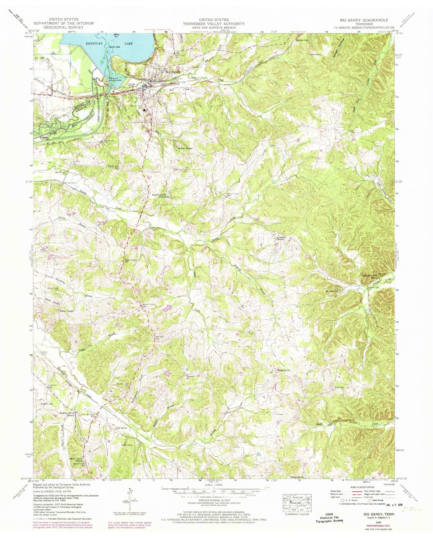
MyTopo
Classic USGS Big Sandy Tennessee 7.5'x7.5' Topo Map
Couldn't load pickup availability
Historical USGS topographic quad map of Big Sandy in the state of Tennessee. Map scale may vary for some years, but is generally around 1:24,000. Print size is approximately 24" x 27"
This quadrangle is in the following counties: Benton, Henry.
The map contains contour lines, roads, rivers, towns, and lakes. Printed on high-quality waterproof paper with UV fade-resistant inks, and shipped rolled.
Contains the following named places: Baker Chapel, Baker Chapel Cemetery, Beasley Branch, Benton Cut, Berry Cemetery, Big Sandy, Big Sandy Division, Big Sandy Dock, Big Sandy Municipal Park, Big Sandy Police Department, Big Sandy Post Office, Big Sandy River Dewatering Area, Big Sandy School, Big Sandy Volunteer Fire Department, Billie Branch, Carpenter School, Cedar Grove Cemetery, Cedar Grove Church of Christ, Cedar Grove School, Crossnoe Lake, Crossnoe Lake Dam, Dry Creek, Flatwoods Cemetery, Flatwoods Church, Herndon School, Hollingsworth Branch, Hudson Cemetery, Jones Branch, Lindsey Cemetery, Luterton Church, McRae Chapel, Morgan School, Mount Zion Baptist Church, Mount Zion Cemetery, Mud Creek, Paffords Branch, Pleasant Valley School, Ramble Creek Baptist Church, Ramble Creek Cemetery, Ramble Creek Drainage Ditch, Reddick Branch, Rushing Cemetery, Rushing Creek Draingage Ditch, Rushings Creek Baptist Church, Rushings Creek Cemetery, Shady Grove Primitive Baptist Church, South Creek, Sugar Creek, Sugar Creek Campground, Sugar Creek Cemetery, Sulphur Creek School, Tie Camp Hollow, Town of Big Sandy, Weatherly Cemetery, ZIP Code: 38221


