Eric Rector covers his face as he runs down a hill from flames racing through the Topanga Canyon area east of Malibu on Nov. 3, 1993, when the last major fire struck the area. A lot of vegetation has built up since then.
(
Mike Nelson
/
AFP
)
Support your source for local news!
In these challenging times, the need for reliable local reporting has never been greater. Put a value on the impact of our year-round coverage. Help us continue to highlight LA stories, hold the powerful accountable, and amplify community voices. Your support keeps our reporting free for all to use. Stand with us today.
Topanga Canyon’s nightmare fire scenario begins in the middle of the night when everyone’s asleep at home.
As blustery Santa Ana winds blow in from the east, a spark from a powerline or a passing car drops onto dry brush, starting a fire along the edge of the San Fernando Valley. As the flames grow, emergency services send out alerts, waking up thousands of residents throughout the area, telling some to shelter in place and others to leave.
It’s an increasingly likely situation as our vegetation dries out and winds pick up, according to Drew Smith, fire behavior analyst with L.A. County Fire.
“I would not be surprised,” Smith told me as we stood atop a helipad looking across the Transverse Ranges. “We are training for that.”
With only a few arteries in and out of the canyon, Smith warns that a fast-moving wildfire could trap people on the canyon’s narrow roads, consuming everything in its path.
In a worst-case scenario, the fire explodes into a devastating tragedy akin to the 2018 Camp Fire in Butte County, which destroyed the town of Paradise, trapping people trying to escape. At least 85 people were killed.
“That’s one thing that keeps me up at night,” he said. “That worst-case scenario fire with our residents at home with limited options. It’s terrifying.”
Preparing for the worst-case scenario
A hilltop near the Eagle Rock fire road burns in Topanga Canyon State Park from the Palisades Fire on May 15, 2021 in Topanga, California.
(
Brian Feinzimer for LAist
)
It’s difficult to emphasize just how dangerous wind driven fires can be, especially where we were standing, near the top of Stunt Road, above Calabasas.
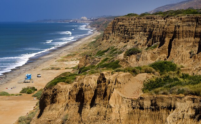
Looking out across the Santa Monica Mountains, you can see small communities tucked in between dense chaparral that hasn’t burned in 30 plus years. Meaning, there’s a whole lot energy ready to fuel fires that roll through.
If the Santa Ana winds are blowing, strong gusts can throw embers more than a mile ahead of a fire front, starting up spot fires all over.
And because of the steep and rocky terrain, firefighting hand crews and bulldozers might struggle to dig fire lines meant to help contain the fire.
Even with water drops from helicopters, containing a fire in nightmarish fall conditions can be all but impossible.
“We know that fire history tells us on a high risk day, if we don’t suppress a fire within the first 10 minutes, it has a high probability of extending to the Pacific,” Smith said.
Drew Smith is a fire behavior analyst with the Los Angeles County Fire Department.
(
Jacob Margolis
/
LAist
)
Smith estimates that it'd take one of these worst case scenario fires about four hours to sweep westward, from the San Fernando Valley to the Pacific Ocean, destroying communities along the way. Just as we saw during the Woolsey Fire in 2018, which made its way 17 miles across L.A. to Malibu in less than 24 hours, destroying 1,600 structures and killing killing three.
"Don't get lured into a false sense of security because we've had a very passive fire season in Los Angeles County," said Smith. "Under the right conditions, we have a high potential for a devastating fire in the Santa Monica Mountains that hasn't seen fire frequency in 25 years."
Topanga isn't the sole community at risk, the threat really applies to those throughout the Santa Monicas.
A key staging area: 69 Bravo
The helipad Smith and I were standing on is called 69 Bravo, and it’ll likely be one of the most important staging areas for firefighters when one of these fires does break out.
It sits at about 2,600 feet above sea level, offering views of Newhall Pass on one side and the Pacific on the other. Below the pads are four 8,000 gallon water tanks that automatically refill, there to be drawn on by helicopters and fire trucks that are working to head off flames on their run to the ocean.
The 69 Bravo helipad sits at about 2,600 feet in the Santa Monica Mountains. It offers views of the Transverse Ranges, the San Fernando Valley and the Pacific Ocean. A critical spot for firefighters battling flames nearby.
(
Jacob Margolis
/
LAist
)
The four, 8,000 gallon tanks at 69 Bravo have open tops so that firetrucks and helicopters can draw directly from them. They automatically refill.
How do you know if conditions are ripe for an extreme fire?
It’s quite likely that many fires will be started – all by people – in the coming months. Though, each won’t become a Woolsey level event.
So how do you know if you should be worried?
Smith laid out some of the key conditions he looks for to figure out if a fire is going to move fast:
Temperatures above 80 degrees
Relative humidities in the single digits
Live plants with moisture levels at 80% or less (they’re usually around 55% by the fall)
Strong, gusty winds
If you want to keep it simple, look out for red flag warnings from the National Weather Service, which indicate that extreme fire behavior is possible.
Check out their Fire Weather Snooper, which presents data from weather stations that are entering or in red flag territory.
On average we get eight red flag events per year, according to Smith, and on average each lasts three days.
How you can prepare and respond
Red flag warning prep
It’s always a good time to prep for disasters, especially before a red flag event arrives:
If you live in a high risk area like Topanga Canyon and a red flag event is on its way:
How to stay safe in high-risk areas
Back your car into your driveway and have your go bag in the car, ready to leave at a moment’s notice
If you get an emergency alert, follow the instructions given by emergency services. They’ll be coordinating evacuations, and will make efforts to keep roads from getting clogged
Consider leaving long before any fire breaks out. Smith said he knows people in Topanga that leave as soon as a red flag event starts
Unsure if you live in a high risk area? Check out the state's Fire Severity Zone map for your county.
Listen to our podcast
How did wildfire risks get so bad? What can you do to stay safe? We have answers in our 2022 podcast, "The Big Burn," from LAist Studios.